
*Free Shipping Over $129 - 30 Day Returns on Most Items - Most Items Ship in 1–2 Business Days

Humminbird CoastMaster™ Premium Edition - Florida - Version 2
$454.99
Sale price
$454.99
Regular price
$599.99
Skip to product information


Humminbird CoastMaster™ Premium Edition - Florida - Version 2
Model602014-2SKUHUM-602014-2
Elliott’s priceSave $145Free shipping
$454.99
Sale price
$454.99
Regular price
$599.99
·
Free shipping
Orders over $129
30-day returns
Hassle-free policy
Secure checkout
Payment protected
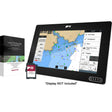
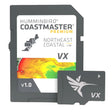
The Humminbird CoastMaster Premium Edition Florida V2 delivers highly accurate chart coverage for all Florida waters and the Bahamas on a single card. Depth-shaded contours, aerial imagery, bottom hardness data, and predictive tidal and current tools give saltwater anglers the situational awareness to locate fish-holding structure and navigate safely in shallow coastal environments.
Specifications:
- Covers all Florida coastal and inland waters plus the Bahamas
- Florida Boat Lanes included with tracks labeled by actual depth; safety depth feature highlights shallow areas in red based on your vessel's draft
- Bahamas coverage includes exclusive shallow-water contours and shaded relief
- High-definition shaded relief for the Florida Keys and other heavily fished areas
- Compatible with all Humminbird APEX, all XPLORE, and SOLIX G3N models
- 2D Shaded Relief layer surfaces bottom detail and depth transitions at a glance
- Enhanced Aerial Imagery delivers clear water-column visibility for scouting unfamiliar areas
- Bottom Hardness layer identifies substrate composition to pinpoint fish-holding zones
- Predictive tidal and current tools display direction, height, speed, and timing for advance trip planning
- Adjustable shallow-water shading from 0 to 30 feet
- Water Level Offset synchronizes chart contours and shorelines to real-time water levels at your fishing location
Resources: