
*Free Shipping Over $129 - 30 Day Returns on Most Items - Most Items Ship in 1–2 Business Days

Garmin BlueChart® g3 HD - HXUS604x - US All & Canadian West - microSD™/SD™


Garmin BlueChart® g3 HD - HXUS604x - US All & Canadian West - microSD™/SD™
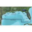
The Garmin BlueChart g3 HD HXUS604x packs integrated Garmin and Navionics chart data onto a single microSD/SD card, covering U.S. coastal waters from the East Coast and Gulf Coast to the West Coast, Alaska, Hawaii, major inland rivers, the Great Lakes, and a broad sweep of Caribbean and Canadian waters. Auto Guidance, Depth Range Shading, and up to 1-foot contours give anglers and navigators the detail they need across a wide variety of waterways and fishing grounds.
Coverage includes: U.S. East Coast from Key West, FL to the Canadian border; West Coast from Puget Sound to the Mexican border; Alaska; Hawaii; major inland rivers; U.S. Gulf Coast to the Mexican border and Mexican Gulf Coast to the Yucatan; the entire St. Lawrence Seaway, Nova Scotia, New Brunswick, Prince Edward Island, and Anticosti Island; Vancouver Island with Inside and Outside Passages; the Great Lakes; Lake of the Woods; the Aleutian and Channel Islands; the Bahamas; Turks and Caicos Islands; Cozumel; Cuba; Hispaniola; Puerto Rico; and the U.S. Virgin Islands.
Specifications:
- Format: microSD/SD card
- Chart data: Integrated Garmin and Navionics data
- Auto Guidance technology calculates suggested routes based on user-defined depth and overhead clearance — for planning purposes only and does not replace safe navigation practices
- Depth Range Shading supports up to 10 user-defined depth ranges for quick target-depth identification at a glance
- Up to 1-foot contours for detailed bottom structure depiction, useful for fishing applications and navigation in swamps, canals, and marinas
- Shallow Water Shading highlights user-defined shallow depths to help identify potential hazards
- NOAA raster cartography available as a free downloadable feature via the ActiveCaptain app, providing paper chart-style views with labeled longitude and latitude points of interest — not viewable on echoMAP CHIRP or echoMAP Plus combos; viewable on mobile devices via ActiveCaptain
- Worldwide regional coverage available separately as accessory cards or via download
- Garmin Device Compatibility List
This product may not be returned to the original point of purchase. Please contact the manufacturer directly with any issues.
⚠️ California Prop 65 Warning: This product can expose you to chemicals known to the State of California to cause cancer, birth defects, or other reproductive harm. For more information visit P65Warnings.ca.gov.