
*Free Shipping Over $129 - 30 Day Returns on Most Items - Most Items Ship in 1–2 Business Days

Garmin BlueChart® g3 Vision® HD - VUS007R - Norfolk - Charleston - microSD™/SD™


Garmin BlueChart® g3 Vision® HD - VUS007R - Norfolk - Charleston - microSD™/SD™
Capt. Joel will email you the moment this lands. No spam, one message.
Similar cartography & charts we have in stock now
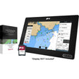 Raymarine LightHouse Chart North America
$169.99 · In stock
Raymarine LightHouse Chart North America
$169.99 · In stock
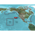 Garmin BlueChart® g3 HD - HXUS604x - US All & Canadian West - microSD™/SD™
$199.99 · In stock
Garmin BlueChart® g3 HD - HXUS604x - US All & Canadian West - microSD™/SD™
$199.99 · In stock
 Humminbird CoastMaster® Premium Northeast Coastal V1
$232.99 · In stock
Humminbird CoastMaster® Premium Northeast Coastal V1
$232.99 · In stock
Not sure what fits your boat? Call (360) 504-8112
The Garmin BlueChart g3 Vision HD VUS007R charts the Atlantic coastline from Newport News, VA to Charleston, SC — spanning Pamlico Sound, Cape Lookout, and Cape Romain — on a plug-and-play microSD/SD card. It merges Garmin and Navionics datasets to deliver sharp contour detail, Auto Guidance routing, and layered 3D views that give coastal boaters and anglers a confident read of Mid-Atlantic and South Atlantic inshore waters.
Specifications:
- Coverage: Newport News, VA to Charleston, SC, including Pamlico Sound, Cape Lookout, and Cape Romain
- Format: microSD/SD card
- Integrates Garmin and Navionics data for industry-leading coastal chart coverage, clarity, and detail
- Auto Guidance technology calculates routes based on your desired depth and overhead clearance, displaying a suggested path (for planning purposes only; does not replace safe navigation practices)
- High-resolution relief shading blends color and shadow to reveal bottom structure beyond what contour lines alone can show
- Up to 1-foot contours for precise bottom-structure depiction in swamps, canals, and marinas
- Depth Range Shading supports up to 10 configurable depth ranges for quick target-depth identification at a glance
- Shallow Water Shading lets you designate and highlight specific shallow depths to avoid
- High-resolution satellite imagery of ports, marinas, bridges, and navigational landmarks for enhanced situational awareness
- MarinerEye and FishEye 3D views provide perspective both above and below the waterline
- NOAA Raster Cartography available as a free downloadable feature via the ActiveCaptain app (not viewable on echoMAP CHIRP and echoMAP Plus combos; viewable on mobile devices via the ActiveCaptain mobile app)
Resources:
This product may not be returned to the original point of purchase. Please contact the manufacturer directly with any issues or concerns.
⚠️ California Prop 65 Warning: This product can expose you to chemicals known to the State of California to cause cancer, birth defects, or other reproductive harm. For more information, visit P65Warnings.ca.gov.