
*Free Shipping Over $129 - 30 Day Returns on Most Items - Most Items Ship in 1–2 Business Days

Furuno U.S. East Coast, Bahamas & Bermuda - Vector Charts & Standard Resolution Satellite Photos f/Bahamas - Unlock Code


Furuno U.S. East Coast, Bahamas & Bermuda - Vector Charts & Standard Resolution Satellite Photos f/Bahamas - Unlock Code
Capt. Joel will email you the moment this lands. No spam, one message.
Similar cartography & charts we have in stock now
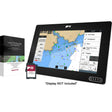 Raymarine LightHouse Chart North America
$169.99 · In stock
Raymarine LightHouse Chart North America
$169.99 · In stock
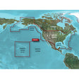 Garmin BlueChart® g3 HD - HXUS604x - US All & Canadian West - microSD™/SD™
$199.99 · In stock
Garmin BlueChart® g3 HD - HXUS604x - US All & Canadian West - microSD™/SD™
$199.99 · In stock
 Humminbird CoastMaster® Premium Northeast Coastal V1
$232.99 · In stock
Humminbird CoastMaster® Premium Northeast Coastal V1
$232.99 · In stock
Not sure what fits your boat? Call (360) 504-8112
Extend your Furuno NavNet chartplotter with full vector chart coverage of the U.S. East Coast, Bahamas, and Bermuda, plus standard-resolution satellite photography of the Bahamas. Built on the same cartographic data found in C-MAP MAX and C-MAP MAX PRO charts, this unlock code delivers detailed, reliable charting for coastal and offshore navigation throughout the region. A System ID number is required at the time of purchase — locate it under the "My NavNet" menu on your NavNet 3D, TZT, or TZT2 unit, and provide it to an authorized Furuno dealer to receive your unlock code.
Specifications:
- Coverage: U.S. East Coast, Bahamas, and Bermuda
- Chart type: Vector charts
- Bonus imagery: Standard-resolution satellite photography for the Bahamas
- Chart data: Equivalent to C-MAP MAX and C-MAP MAX PRO cartographic information
- Compatible systems: NavNet 3D, NavNet TZT, NavNet TZT2
- Delivery method: Unlock code (System ID number required to receive code)
- System ID location: Found under the "My NavNet" menu on the chartplotter
⚠️ California Prop 65 Warning: This product can expose you to chemicals known to the State of California to cause cancer, birth defects, or other reproductive harm. For more information visit P65Warnings.ca.gov.