
*Free Shipping Over $129 - 30 Day Returns on Most Items - Most Items Ship in 1–2 Business Days

Humminbird XPLORE 10 CMSI+


Humminbird XPLORE 10 CMSI+
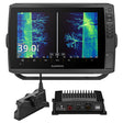
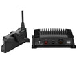
The Humminbird XPLORE 10 CMSI+ brings together a 10-inch Full-HD display, MEGA Side Imaging+, MEGA Down Imaging+, and Dual Spectrum CHIRP Sonar in a single unit built for serious anglers. What sets the XPLORE series apart is the inclusion of both LakeMaster and CoastMaster map cards covering 13 regions across the United States and Canada — right out of the box. Wi-Fi, Bluetooth, NMEA 2000, and Ethernet networking allow full integration with the One-Boat Network ecosystem of Humminbird, Minn Kota, and Cannon products.
Full-HD Display with Cross Touch Interface
The 1280H x 720V display renders sonar and chart imagery with exceptional clarity. Navigation is handled through your choice of touchscreen or keypad controls, giving you full flexibility on the water.
Dual Spectrum CHIRP Sonar
Powered by a proprietary Low-Q CHIRP transducer, Dual Spectrum CHIRP offers two search modes: Wide Mode for broad coverage and Narrow Mode for precise detail. Fish arches and bottom structure are rendered with high definition before you make your first cast.
MEGA Side Imaging+
Side Imaging+ delivers crystal-clear views out to 200 feet on either side of the boat, with 20% more detail and 60% more range than standard MEGA Side Imaging sonar — revealing fish and structure you would otherwise miss.
MEGA Down Imaging+
Down Imaging+ provides underwater clarity to depths of 200 feet directly below the hull, with 20% more detail and 60% greater depth capability compared to standard MEGA Down Imaging sonar.
Internal GPS and Humminbird Basemap
The built-in GPS pairs with an enhanced basemap covering more than 10,000 lakes plus coastal areas for the continental U.S. Buoys, hazards, marinas, depth markers, contours, and points of interest are all clearly identified for confident navigation and fishing.
Premium Chart Compatibility
Included LakeMaster and CoastMaster mapping cards provide North American standard data across 13 regions in the U.S. and Canada. Compatible with optional Navionics charts for expanded coverage options.
AutoChart Live
Map depth contours, bottom hardness, and vegetation in real time as you navigate your fishing area. Eight hours of built-in recording time comes standard, and compatibility with AutoChart Zero Line SD cards enables virtually unlimited mapping capacity.
One-Boat Network Compatible
Wi-Fi, Bluetooth, NMEA 2000, and Ethernet connectivity allow the XPLORE 10 CMSI+ to communicate with compatible Minn Kota and Cannon products, unlocking expanded boat control and fish-finding features through the One-Boat Network.
Specifications:
- Display: 10-inch Full-HD, 1280H x 720V resolution
- Interface: Cross Touch (touchscreen and keypad)
- Sonar: MEGA Side Imaging+, MEGA Down Imaging+, Dual Spectrum CHIRP
- MEGA Side Imaging+ range: up to 200 feet per side (20% more detail, 60% more range vs. MEGA Side Imaging)
- MEGA Down Imaging+ depth: up to 200 feet (20% more detail, 60% more depth vs. MEGA Down Imaging)
- MEGA Imaging+ combined coverage: up to 250 feet below and to either side
- CHIRP transducer type: Low-Q proprietary; Wide Mode and Narrow Mode
- GPS: Internal
- Basemap: Humminbird Basemap — 10,000+ lakes, continental U.S. coastal coverage
- Included maps: LakeMaster and CoastMaster cards, 13 regions (U.S. and Canada)
- Chart compatibility: Humminbird LakeMaster, CoastMaster, Navionics
- AutoChart Live: Built-in, 8 hours standard recording; compatible with AutoChart Zero Line SD cards
- Networking: Wi-Fi, Bluetooth, NMEA 2000, Ethernet
- One-Boat Network compatible: Humminbird, Minn Kota, Cannon