
*Free Shipping Over $129 - 30 Day Returns on Most Items - Most Items Ship in 1–2 Business Days

Humminbird LakeMaster® VX Premium Manitoba V2.0
$199.99
Sale price
$199.99
Regular price
Skip to product information


Humminbird LakeMaster® VX Premium Manitoba V2.0
Model602019-2SKUHUM-602019-2
Elliott’s priceFree shipping
$199.99
Sale price
$199.99
Regular price
·
Free shipping
Orders over $129
30-day returns
Hassle-free policy
Secure checkout
Payment protected
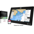
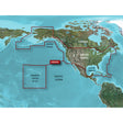
The Humminbird LakeMaster VX Premium Manitoba V2.0 chart card brings high-resolution lake mapping to Manitoba's waters, pairing 2D shaded relief with aerial imagery so you can read bottom structure at a glance and locate fish-holding areas with confidence. VX Technology delivers fast map rendering and customizable color palettes across compatible Humminbird units.
Specifications:
- Compatible with Humminbird HELIX G3/G3N and newer, all SOLIX units, all APEX units, and all XPLORE units
- 2D Shaded Relief — bottom detail and depth transitions are visually enhanced for quick identification of fish-holding structure
- Aerial Imagery — overhead photography aids navigation and helps reveal new fishing locations
- VX Technology — delivers high-speed map performance and customizable color palettes
- SmartStrike — highlights areas of the lake map where fish are most likely to be active (select HD Lakes only)
- Chart Presets — store and switch between personalized map view configurations with ease
- Depth Highlight — select a specific depth range to isolate and target productive water
- Shallow Water Highlight — red shading marks shallow water on an adjustable range from 0 to 60 feet
- Water Level Offset — synchronizes depth contours and shorelines with actual current water levels on lakes, reservoirs, and rivers
- One-Boat Network — links your LakeMaster chart with a Minn Kota trolling motor to automatically follow a selected depth contour
- 1-Year Cartography Warranty — opened packages are not eligible for return