
*Free Shipping Over $129 - 30 Day Returns on Most Items - Most Items Ship in 1–2 Business Days

Garmin Navionics Vision+™ NVSA005L - Chile, Argentina & Easter Island - Marine Charts


Garmin Navionics Vision+™ NVSA005L - Chile, Argentina & Easter Island - Marine Charts
Capt. Joel will email you the moment this lands. No spam, one message.
Similar cartography & charts we have in stock now
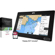 Raymarine LightHouse Chart North America
$169.99 · In stock
Raymarine LightHouse Chart North America
$169.99 · In stock
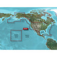 Garmin BlueChart® g3 HD - HXUS604x - US All & Canadian West - microSD™/SD™
$199.99 · In stock
Garmin BlueChart® g3 HD - HXUS604x - US All & Canadian West - microSD™/SD™
$199.99 · In stock
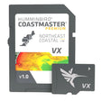 Humminbird CoastMaster® Premium Northeast Coastal V1
$232.99 · In stock
Humminbird CoastMaster® Premium Northeast Coastal V1
$232.99 · In stock
Not sure what fits your boat? Call (360) 504-8112
Garmin Navionics Vision+ NVSA005L delivers integrated coastal and inland chart coverage for Chile, Argentina, and Easter Island on compatible Garmin chartplotters. A one-year ActiveCaptain subscription keeps cartography current with up to 5,000 daily updates, while Auto Guidance+, high-resolution depth shading, satellite imagery, and 3D perspective views give you a thorough picture of South American and Pacific Island waters.
Features:
- Combined offshore and inland lake coverage built for Garmin chartplotters
- Customizable chart layers and overlay combinations for a tailored display
- One-year subscription to daily chart updates through the ActiveCaptain smart-device app
- Auto Guidance+ generates suggested dock-to-dock routes through channels, inlets, and marina entrances — for planning purposes only; does not replace safe navigation practices
- High-resolution depth range shading with up to 10 user-selectable color-shaded target depth ranges
- Up to 1-foot contours for detailed bottom structure, plus enhanced detail in swamps, canals, harbors, and marinas
- User-defined shallow water shading to flag areas to avoid
- Community-sourced points of interest including marinas, anchorages, hazards, and local businesses with firsthand boater recommendations
- Downloadable Depth Range Shading combines color and shadow for clearer bottom-structure interpretation beyond contour lines alone (subscription required)
- Downloadable high-resolution satellite imagery for superior situational awareness (subscription required)
- Aerial and surface photos of ports, marinas, bridges, docks, boat ramps, dams, and navigational landmarks
- Underwater 3D perspective renders bottom structure and contours as viewed from below the waterline, with optional sonar data overlay
- Above-and-below 3D view displays surrounding terrain on both sides of the waterline
- Water level offset tool adjusts maps to current lake levels to assess accessibility and depth
- Chart database receives up to 5,000 updates daily to keep cartography current with new and amended content
- Subscription renewable after the first year to maintain access to daily updates and new downloadable content
Specifications:
- Part Number: NVSA005L
- Coverage: Chile, Argentina, and Easter Island
- Chart Type: Marine (coastal and inland)
- Compatible Platform: Garmin chartplotters
- Subscription Included: One year — daily chart updates via ActiveCaptain app
- Auto Guidance+: Dock-to-dock suggested routing (planning purposes only)
- Depth Shading: Up to 10 color-shaded target depth ranges
- Contour Detail: Up to 1-foot contours
- Additional Downloadable Content: High-resolution satellite imagery, Depth Range Shading (subscription required)
- Note: Raster cartography cannot be viewed on echoMAP CHIRP or echoMAP Plus combos but is viewable on mobile devices via the ActiveCaptain app