
*Free Shipping Over $129 - 30 Day Returns on Most Items - Most Items Ship in 1–2 Business Days

Garmin Navionics+™ NSUS012R Canada, East & Great Lakes
$144.99
Sale price
$144.99
Regular price
Skip to product information


Garmin Navionics+™ NSUS012R Canada, East & Great Lakes
Model010-C1484-20SKUGAR-010-C1484-20
Elliott’s priceFree shipping
$144.99
Sale price
$144.99
Regular price
·
Free shipping
Orders over $129
30-day returns
Hassle-free policy
Secure checkout
Payment protected
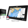
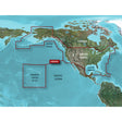
The Garmin Navionics+ NSUS012R covers Eastern Canada and all of the Great Lakes on a single microSD/SD card, combining high-resolution contour data, daily chart updates, and smart routing technology into one chart solution for freshwater and coastal boating alike. From the Grand Banks to inland Great Lakes harbors, this card delivers the detail anglers and cruisers need to navigate with confidence.
Specifications:
- Card format: microSD/SD
- Coverage region: Eastern Canada (excluding YT and NU), all Great Lakes, St. Lawrence River, Maritime Provinces, and Grand Banks
- Subscription: one-year included; renewable for continued daily updates and new content downloads
- Daily chart updates: up to 5,000 per day via the ActiveCaptain app
- Auto Guidance+ technology: generates suggested dock-to-dock routing through channels, inlets, and marina entrances -- intended for planning purposes only and does not replace safe navigation practices
- Depth range shading: up to 10 color-coded target depth ranges
- Contour resolution: up to 1-foot contours for detailed bottom structure in harbors, marinas, canals, and swamps
- Shallow water shading: user-defined depth threshold highlighting
- Chart layers: customizable view with multiple layer and overlay combinations
- Community content: ActiveCaptain-sourced POIs including marinas, anchorages, hazards, and local businesses
- Compatible with: Garmin chartplotters
Resources: