
*Free Shipping Over $129 - 30 Day Returns on Most Items - Most Items Ship in 1–2 Business Days

Garmin Navionics+™ NSUS008R U.S. West


Garmin Navionics+™ NSUS008R U.S. West
Capt. Joel will email you the moment this lands. No spam, one message.
Similar cartography & charts we have in stock now
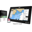 Raymarine LightHouse Chart North America
$169.99 · In stock
Raymarine LightHouse Chart North America
$169.99 · In stock
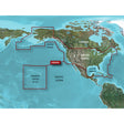 Garmin BlueChart® g3 HD - HXUS604x - US All & Canadian West - microSD™/SD™
$199.99 · In stock
Garmin BlueChart® g3 HD - HXUS604x - US All & Canadian West - microSD™/SD™
$199.99 · In stock
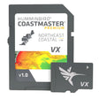 Humminbird CoastMaster® Premium Northeast Coastal V1
$232.99 · In stock
Humminbird CoastMaster® Premium Northeast Coastal V1
$232.99 · In stock
Not sure what fits your boat? Call (360) 504-8112
The Garmin Navionics+ NSUS008R U.S. West chart card combines Garmin and Navionics cartography into a single microSD card covering coastal waters, lakes, and rivers throughout the western United States. SonarChart HD renders bottom structure at contours up to 1 ft (0.5 m), Fishing Range lets you target a specific depth band, and dock-to-dock route guidance calculates a suggested path using your boat settings and chart data. Daily updates keep the card current via Navionics Chart Installer software or wirelessly through Plotter Sync with the Navionics Boating app.
Features:
- Integrated Garmin and Navionics content for strong coverage, clarity, and detail in a familiar chartplotter interface
- Daily chart updates available through Navionics Chart Installer software or wirelessly via Plotter Sync with the Navionics Boating app (Plotter Sync requires the Navionics Boating app on a compatible smart device with an active subscription for the same area)
- Advanced dock-to-dock route guidance uses boat settings, chart data, and frequently traveled routes to suggest a navigation path (route guidance is for planning purposes only and does not replace safe navigation practices)
- Community Edits layer can be downloaded to any Navionics card, displaying locally contributed information from Navionics Boating app users on your compatible chartplotter
- SonarChart HD bathymetry maps render contours up to 1 ft (0.5 m) for a detailed view of bottom structure — useful for both fishing and navigation
- Fishing Range advanced feature lets you highlight a user-defined target depth range
- Shallow water shading advanced feature marks depths up to a user-defined level to support safer navigation
- SonarChart Live creates new personal 1 ft HD bathymetry maps in real time on compatible chartplotter screens while underway
- Worldwide coverage available
- Delivered on microSD card; first year of chart updates included, with updates available via annual renewable subscription thereafter
Compatibility:
- Echomap UHD (7/9)
- Echomap Ultra (10/12)
- GPSmap 10X2 / 12X2
- GPSmap 12X2 Touch
- GPSmap 7X2, 9X2, 12X2 Plus
- GPSmap 7X3 / 9X3 / 12X3
- GPSmap 8400 / 8600
- GPSmap 8700 Black Box
Resources: