
*Free Shipping Over $129 - 30 Day Returns on Most Items - Most Items Ship in 1–2 Business Days

Garmin Navionics+ NSUS001L US & Coastal Canada
$188.99
Sale price
$188.99
Regular price
Skip to product information


Garmin Navionics+ NSUS001L US & Coastal Canada
Model010-C1287-20SKUGAR-010-C1287-20
Elliott’s priceFree shipping
$188.99
Sale price
$188.99
Regular price
·
Free shipping
Orders over $129
30-day returns
Hassle-free policy
Secure checkout
Payment protected
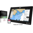
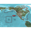
The Garmin Navionics+ NSUS001L packs integrated Garmin and Navionics marine cartography for US and coastal Canadian waters — including lakes and rivers — onto a single microSD card. SonarChart HD delivers bottom structure detail down to 1-foot resolution, dock-to-dock route guidance helps plan passages through channels and marina entrances, and daily chart updates keep your data current whether you're running offshore bluewater, nearshore, or inland.
Features:
- Integrated Garmin and Navionics content provides broad coverage, sharp detail, and a familiar chartplotter interface
- Daily chart updates available through the Navionics Chart Installer software or wirelessly via Plotter Sync using the Navionics Boating app on a compatible smart device with an active subscription for the same coverage area
- Dock-to-dock advanced route guidance factors in boat settings, chart data, and frequently traveled routes to calculate a suggested path through channels, inlets, and marina entrances — for planning purposes only; does not replace safe navigation practices
- Community Edits content layer downloadable to any Navionics card, displaying locally contributed information from Navionics Boating app users on compatible chartplotters
- SonarChart HD bathymetry renders bottom contours at up to 1-foot (0.5 m) resolution for precise depth depiction
- Fishing Range advanced feature highlights a user-defined target depth range to help locate productive fishing areas
- Shallow Water Shading advanced feature highlights depths up to a user-defined level to support safe navigation
- SonarChart Live creates new personal 1-foot HD bathymetry maps in real time on compatible chartplotters while underway
- Worldwide coverage available
- Delivered on microSD card; first year of cartography updates included, with annual renewable subscription available thereafter
Compatibility:
- Echomap UHD (7/9)
- Echomap Ultra (10/12)
- GPSmap 10X2 / 12X2
- GPSmap 12X2 Touch
- GPSmap 7X2, 9X2, 12X2 Plus
- GPSmap 7X3 / 9X3 / 12X3
- GPSmap 8400 / 8600
- GPSmap 8700 Black Box
Resources: