
*Free Shipping Over $129 - 30 Day Returns on Most Items - Most Items Ship in 1–2 Business Days

Garmin Navionics+™ BUS001L U.S. & Coastal Canada Built-In Chart Updates - microSD™/SD™ & 1-Year Subscription


Garmin Navionics+™ BUS001L U.S. & Coastal Canada Built-In Chart Updates - microSD™/SD™ & 1-Year Subscription
Capt. Joel will email you the moment this lands. No spam, one message.
Similar cartography & charts we have in stock now
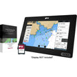 Raymarine LightHouse Chart North America
$169.99 · In stock
Raymarine LightHouse Chart North America
$169.99 · In stock
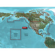 Garmin BlueChart® g3 HD - HXUS604x - US All & Canadian West - microSD™/SD™
$199.99 · In stock
Garmin BlueChart® g3 HD - HXUS604x - US All & Canadian West - microSD™/SD™
$199.99 · In stock
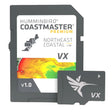 Humminbird CoastMaster® Premium Northeast Coastal V1
$232.99 · In stock
Humminbird CoastMaster® Premium Northeast Coastal V1
$232.99 · In stock
Not sure what fits your boat? Call (360) 504-8112
The Garmin Navionics+ BUS001L upgrades chartplotters originally loaded with built-in BlueChart g3 coastal or LakeVü g3 inland maps to the full Navionics+ cartography platform — covering U.S. coastal waters, coastal Canada, and inland lakes and rivers on a single microSD/SD card. A one-year subscription delivers daily chart updates through the ActiveCaptain app, keeping your charts current whether you're running offshore canyons, Gulf Coast passes, Great Lakes tributaries, or inland reservoirs. Confirm compatibility with your Garmin chartplotter before ordering.
Specifications:
- Coverage: U.S. coastal waters and coastal Canada, plus inland lakes and rivers
- Card format: microSD/SD
- Intended use: Upgrades chartplotters with built-in BlueChart g3 coastal or LakeVü g3 inland maps to Garmin Navionics+ cartography
- Includes a one-year subscription for daily chart updates via the ActiveCaptain smart-device app
- Auto Guidance+ technology generates suggested dock-to-dock routes through channels, inlets, and marina entrances (for planning purposes only — does not replace safe navigation practices)
- Depth range shading: configure up to 10 color-shaded target depth ranges
- Contour detail: up to 1-foot contours depicting bottom structure, swamps, canals, harbors, and marinas
- Shallow water shading adjustable to a user-defined depth threshold
- Customizable chart layers and overlay combinations
- NOAA raster cartography available as a free download via ActiveCaptain for select U.S. waters (not viewable on echoMAP CHIRP or echoMAP Plus combos on the plotter; viewable on mobile devices through the ActiveCaptain mobile app)
- ActiveCaptain Community content includes crowd-sourced POIs: marinas, anchorages, hazards, and local businesses
- Subscription renewal available to maintain access to daily updates and new content downloads