
*Free Shipping Over $129 - 30 Day Returns on Most Items - Most Items Ship in 1–2 Business Days

Garmin Canada LakeVü™ g3 Ultra - LVCA100F - microSD™/SD™


Garmin Canada LakeVü™ g3 Ultra - LVCA100F - microSD™/SD™
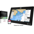
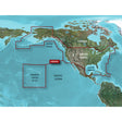
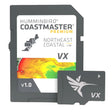
The Garmin Canada LakeVü g3 Ultra (LVCA100F) on microSD/SD card brings together Garmin and Navionics content across more than 13,500 Canadian lakes, pairing high-detail contour data with a full set of depth and structure visualization tools designed for serious freshwater fishing.
Specifications:
- Coverage spans more than 13,500 Canadian lakes total, with more than 4,800 lakes offering contours up to 1-foot resolution
- Integrated Garmin and Navionics content delivers industry-leading inland mapping clarity and detail
- Auto Guidance technology generates a suggested route based on your chosen depth and overhead clearance parameters -- intended for planning purposes only and does not substitute for safe navigation practices
- High-resolution Relief Shading adds a visual depth dimension to the 2-D chart, making contours and fish-holding structure easier to read at a glance
- Depth Range Shading supports up to 10 user-customizable depth ranges for quick target-depth identification
- Shallow Water Shading highlights user-defined shallow zones to help identify potential hazards
- Dynamic Lake Level adjustment lets you calibrate charts to current water conditions, distinguishing navigable areas from those that are too shallow
- FishEye View renders a 3-D underwater perspective of lake bottom terrain and contours, with optional sonar data overlay for a customized display
- MarinerEye View provides a 3-D above-and-below-waterline representation of surrounding terrain
- Compatible with the ActiveCaptain app via OneChart for mobile chart access and purchases
- Card format: microSD/SD
This product may not be returned to the original point of purchase. Please contact the manufacturer directly with any issues or concerns.
⚠️ California Prop 65 Warning: WARNING: This product can expose you to chemicals known to the State of California to cause cancer, birth defects, or other reproductive harm. For more information, visit P65Warnings.ca.gov.