
*Free Shipping Over $129 - 30 Day Returns on Most Items - Most Items Ship in 1–2 Business Days

Garmin BlueChart® g3 Vision® HD - VUS025R - Anchorage - Juneau - microSD™/SD™


Garmin BlueChart® g3 Vision® HD - VUS025R - Anchorage - Juneau - microSD™/SD™
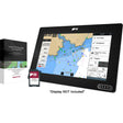
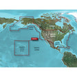
The Garmin BlueChart g3 Vision HD VUS025R charts the Alaska coastal corridor from Juneau to Alinchak Bay, combining integrated Garmin and Navionics data with advanced routing and rendering tools for fishing, cruising, and marina navigation across Prince William Sound, Cook Inlet, Kodiak Island, Glacier Bay, Icy Strait, and Yakutat.
Specifications:
- Chart region: Juneau to Alinchak Bay, including Kodiak Island, Cook Inlet, Prince William Sound, Yakutat, Glacier Bay, and Icy Strait
- Format: microSD/SD card
- Integrated Garmin and Navionics data for comprehensive coastal coverage, clarity, and detail
- Auto Guidance technology calculates a suggested route based on your preferred depth and overhead clearance (for planning purposes only; does not replace safe navigation practices)
- High-resolution relief shading uses color and shadow to convey bottom structure beyond what contour lines alone can show
- Up to 1-foot contours for precise bottom structure depiction — useful for fishing, swamps, canals, and marinas
- Depth Range Shading supports up to 10 depth ranges for quick target-depth identification
- Shallow Water Shading lets you define and highlight depths you want to avoid
- High-resolution satellite imagery of ports, marinas, bridges, and navigational landmarks for improved situational awareness
- MarinerEye and FishEye 3-D views provide above- and below-waterline perspectives
- NOAA raster cartography available as a free downloadable feature via the ActiveCaptain app (not viewable on echoMAP CHIRP and ECHOMAP Plus combos; viewable on mobile devices through the ActiveCaptain mobile app)
Resources:
This product may not be returned to the original point of purchase. Please contact the manufacturer directly with any issues or concerns.
⚠️ California Prop 65 Warning: This product can expose you to chemicals known to the State of California to cause cancer, birth defects, or other reproductive harm. For more information go to P65Warnings.ca.gov.