
*Free Shipping Over $129 - 30 Day Returns on Most Items - Most Items Ship in 1–2 Business Days

Garmin BlueChart® g3 Vision® HD - VUS001R - North Maine - microSD™/SD™


Garmin BlueChart® g3 Vision® HD - VUS001R - North Maine - microSD™/SD™
Capt. Joel will email you the moment this lands. No spam, one message.
Similar cartography & charts we have in stock now
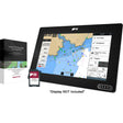 Raymarine LightHouse Chart North America
$169.99 · In stock
Raymarine LightHouse Chart North America
$169.99 · In stock
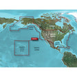 Garmin BlueChart® g3 HD - HXUS604x - US All & Canadian West - microSD™/SD™
$199.99 · In stock
Garmin BlueChart® g3 HD - HXUS604x - US All & Canadian West - microSD™/SD™
$199.99 · In stock
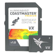 Humminbird CoastMaster® Premium Northeast Coastal V1
$232.99 · In stock
Humminbird CoastMaster® Premium Northeast Coastal V1
$232.99 · In stock
Not sure what fits your boat? Call (360) 504-8112
The Garmin BlueChart g3 Vision HD VUS001R brings together integrated Garmin and Navionics data to deliver detailed coastal charts for the North Maine coast, from Calais to Camden — covering Bar Harbor and Penobscot Bay. Auto Guidance technology, 1-foot contours, and high-resolution relief shading give you the precision you need for both navigation and fishing on a standard microSD/SD card.
Specifications:
- Coverage: Calais to Camden, including Bar Harbor and Penobscot Bay
- Integrated Garmin and Navionics data for industry-leading coastal chart coverage, clarity, and detail
- Auto Guidance technology calculates routes based on your desired depth and overhead clearance to suggest a path to follow
- High-resolution relief shading blends color and shadow to reveal bottom structure beyond what contour lines alone show
- Depth Range Shading supports up to 10 depth ranges for quick at-a-glance target depth identification
- Up to 1-foot contours for accurate bottom structure depiction in fishing, swamp, canal, and marina navigation
- Shallow Water Shading lets you designate and highlight shallow depths to avoid
- NOAA Raster Cartography available as a free downloadable feature via the ActiveCaptain app for a paper-chart-style display
- High-resolution satellite imagery of ports, marinas, bridges, and navigational landmarks for enhanced situational awareness
- MarinerEye and FishEye 3-D views provide above- and below-waterline perspective
- Media format: microSD/SD
Auto Guidance is intended for planning purposes only and does not replace safe navigation practices. Raster cartography cannot be viewed on echoMAP CHIRP and ECHOMAP Plus combos but can be viewed on mobile devices via the ActiveCaptain mobile app.
This product may not be returned to the original point of purchase. Please contact the manufacturer directly with any issues or concerns.
Resources:
⚠️ California Prop 65 Warning: This product can expose you to chemicals which are known to the State of California to cause cancer, birth defects or other reproductive harm. For more information go to P65Warnings.ca.gov.