
*Free Shipping Over $129 - 30 Day Returns on Most Items - Most Items Ship in 1–2 Business Days

Garmin BlueChart® g3 HD - HXUS030R - Southeast Caribbean - microSD™/SD™


Garmin BlueChart® g3 HD - HXUS030R - Southeast Caribbean - microSD™/SD™
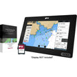
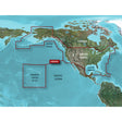
Garmin BlueChart g3 HD HXUS030R delivers high-definition chart coverage of the Southeast Caribbean, combining official government charts with private data sources to give mariners accurate, detailed information across a wide swath of island and coastal waters — from Haiti and Puerto Rico through the Lesser Antilles down to the Venezuelan and Colombian coastlines.
Specifications:
- Coverage spans the Caribbean from Haiti to Trinidad and Tobago, including Puerto Rico and all of the Lesser Antilles
- Also covers the Colombian and Venezuelan coasts from Barranquilla, Colombia to the mouth of the Orinoco River, including Lake Maracaibo and the Gulf of Paria
- Chart data sourced from official charts and private providers
- Includes navigational aids, spot soundings, depth contours, tides and currents, and detailed harbors and marinas
- Depth Range Shading supports up to 10 depth ranges for quick target-depth identification at a glance
- Up to 1-foot contours for precise bottom structure depiction — useful for fishing, swamps, canals, and marina navigation
- Shallow Water Shading is configurable to a user-defined depth level to aid safe navigation
- Format: microSD/SD
Resources:
This product may not be returned to the original point of purchase. Please contact the manufacturer directly with any issues or concerns.
⚠️ California Prop 65 Warning: This product can expose you to chemicals which are known to the State of California to cause cancer, birth defects or other reproductive harm. For more information go to P65Warnings.ca.gov.