
*Free Shipping Over $129 - 30 Day Returns on Most Items - Most Items Ship in 1–2 Business Days

Garmin BlueChart® g3 HD - HXUS029R - Southern Bahamas - microSD™/SD™


Garmin BlueChart® g3 HD - HXUS029R - Southern Bahamas - microSD™/SD™
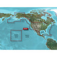
The Garmin BlueChart g3 HD HXUS029R brings high-definition coastal charting to the Southern Bahamas and surrounding waters, combining Garmin and Navionics data with Explorer Charts for the Bahamas. Whether you're threading the Exuma Cays, crossing to Turks and Caicos, or running the coasts of Jamaica, Haiti, or the Dominican Republic, this microSD/SD card loads directly into compatible Garmin chartplotters and delivers the detail needed for confident offshore and island cruising.
Specifications:
- Format: microSD/SD card
- Chart series: BlueChart g3 HD
- Part number: HXUS029R
- Coverage area: Eleuthera Island south to the Dominican Republic, including Great Exuma, Great Inagua, Mayaguana, and additional Bahamian islands; full Jamaican, Haitian, and Dominican coastlines; easternmost quarter of Cuba; Turks and Caicos Islands
- Data source: Integrated Garmin and Navionics data featuring Explorer Charts for the Bahamas
- Auto Guidance technology: calculates a suggested route overlay based on user-defined depth and overhead clearance settings (for planning purposes only — does not replace safe navigation practice)
- Depth Range Shading: supports up to 10 user-defined depth ranges for quick target-depth identification at a glance
- Contour detail: up to 1-foot contours for accurate bottom-structure depiction in open water, swamps, canals, and marinas
- Shallow Water Shading: user-defined depth threshold highlights potentially hazardous shallow areas
- NOAA raster cartography: available as a free downloadable feature via the ActiveCaptain app; delivers paper chart-style views of NOAA-surveyed areas with labeled points of interest including longitude and latitude coordinates (not viewable on echoMAP CHIRP or echoMAP Plus combos; viewable on mobile devices via the ActiveCaptain mobile app)
- Worldwide coverage available by region as accessory cards or via download; each region sold separately
Resources:
This product may not be returned to the original point of purchase. Please contact the manufacturer directly with any issues or concerns.
⚠️ California Prop 65 Warning: This product can expose you to chemicals which are known to the State of California to cause cancer, birth defects or other reproductive harm. For more information go to P65Warnings.ca.gov.