

Table of Contents
- Why Connect Your VHF Radio to Your Marine GPS
- Understanding NMEA 0183 vs NMEA 2000 Wiring Standards
- What You'll Need Before Starting
- Step-by-Step VHF to GPS Connection Process
- DSC Distress Call Setup and GPS Integration
- Troubleshooting Marine GPS Data Transfer Issues
- Common Mistakes to Avoid
- Frequently Asked Questions
Last Updated: September 29, 2026
Why Connect Your VHF Radio to Your Marine GPS
A connected VHF and GPS system transmits your exact position automatically to the Coast Guard via Digital Selective Calling (DSC) if you need help. Beyond safety, the setup saves time, reduces errors, and shows charter clients you're running professional gear.
Learning how to connect VHF to marine GPS involves wiring standards, proper cable selection, and configuration steps. This guide from Elliott's Tackle & Rigging walks you through the entire process. We'll cover the two main wiring protocols, show you what cables you need, and explain the step-by-step setup so your system works reliably.
Understanding NMEA 0183 vs NMEA 2000 Wiring Standards
Both NMEA 0183 and NMEA 2000 carry data between marine electronics. They're not the same. Knowing the difference matters for your installation.
NMEA 0183 Protocol Basics
NMEA 0183 is the older serial communication standard. It sends data one direction at a time across simple twisted-pair wiring using lower voltage signals. It's reliable and proven on thousands of boats, though the data rate is slower than modern alternatives. Most older VHF radios and GPS units speak NMEA 0183.
Data flows through a single twisted pair: one wire carries data out from the GPS, one carries data into the VHF radio, and ground completes the circuit at 4800 bits per second. NMEA 0183 works fine for basic position sharing with simple, straightforward wiring found on many recreational fishing boats and charter vessels.
NMEA 2000 Protocol Basics
NMEA 2000 is the modern plug-and-play standard. It uses a backbone cable with drop connections, allowing multiple devices to communicate simultaneously at higher speeds and voltages. Newer marine electronics almost always include NMEA 2000 ports.
Key differences:
- Uses a thick backbone cable with T-connectors
- Drop cables branch off the backbone
- All devices communicate simultaneously
- Higher data transmission speed
- Self-configuring, devices identify themselves automatically
- Supports more accessory types (autopilots, depth sounders, weather stations)
The Garmin marine electronics documentation specifies NMEA 2000 as the standard for modern vessel networks. If your boat is newer or you're upgrading, NMEA 2000 is the better choice. The Garmin NMEA 2000 Backbone Cable options from Elliott's Tackle & Rigging give you clean, standards-compliant connections. The 4M backbone cable extends your network 13 feet, while the 6M version reaches 18 feet for larger vessels.

What You'll Need Before Starting
Gather these items before you begin:
Core Hardware:
- Your VHF radio (model number handy)
- Your marine GPS chartplotter (model number handy)
- NMEA cable appropriate to your system (0183 or 2000)
- Wire strippers
- Electrical crimpers
- Multimeter (for testing continuity and voltage)
- Heat shrink tubing
- Small flathead screwdriver
- The equipment manuals (check manufacturer websites if you don't have them)
Cable Selection by Protocol:
If your system runs NMEA 0183 (older radios and plotters), you need a serial data cable with twisted-pair shielding. The Garmin NMEA 0183 with Audio Cable combines serial data transmission with audio routing, useful if you're integrating a marine stereo alongside your GPS connection. For NMEA 2000 networks, the 4M backbone cable (13 feet) and 6M backbone cable (18 feet) from Elliott's Tackle & Rigging provide standards-compliant backbone runs with keyed connectors that prevent reverse installation.
Garmin NMEA 2000® Backbone/Drop Cable →

Check your radio and GPS manuals first. They'll tell you which protocol your specific models support. Some older equipment only handles NMEA 0183. Newer systems support both, but default to NMEA 2000.
Modern Wireless Integration Option:
Testing Equipment:
A multimeter is essential to verify continuity across data wires, voltage levels on power pins (typically 5V or 12V), and resistance between data wires and ground. It will save you hours of troubleshooting if something doesn't work on first power-up.
Step-by-Step VHF to GPS Connection Process
Step 1: Identify Your Radio and GPS Models
Write down the exact model numbers. Look at the back of each unit. The model is printed on a label or stamped into the case.
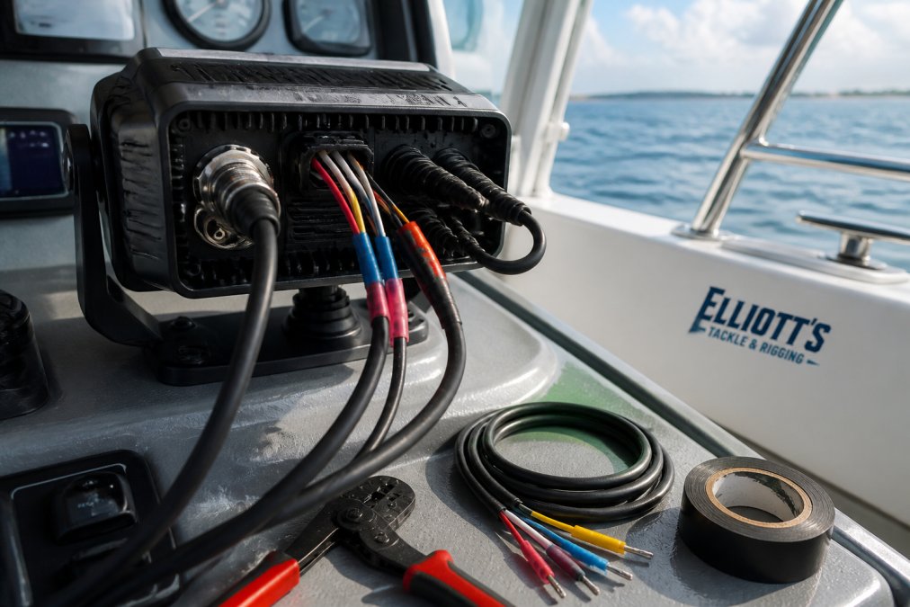
Find the manual for each device. Manufacturer websites host PDFs. Search "[Model Number] manual PDF" and you'll usually find it. The manual shows you:
- Which ports are data in and data out
- What protocol the unit supports
- Pin configurations
- Required baud rates
Knowing your exact models prevents wiring mistakes. A wrong connection can damage ports or create data errors.
Step 2: Locate Data In and Data Out Ports
Turn off power to both devices before touching any ports. Most VHF radios have "Data Out" and "Data In" connectors (sometimes combined into a single jack). Your chartplotter has similar ports. Your manual shows exactly which pins do what, don't guess, as a misconnected pin wastes hours of troubleshooting.
Step 3: Connect the Wiring Harness
For NMEA 0183 systems, run two separate wires (GPS data out to VHF data in, and VHF data out to GPS data in) plus a ground wire. Strip a quarter inch of insulation, insert into the pin connector, and crimp firmly. For NMEA 2000 systems, use backbone and drop cables with keyed connectors, push firmly until you hear a click. Route all cables away from engine noise and power lines to prevent electrical interference.

Step 4: Configure Baud Rate Settings
Baud rate is the speed at which data transmits, both devices must match. Common rates are 4800 bits per second (NMEA 0183), 9600 bits per second (newer equipment), and 38400 bits per second (NMEA 2000). Access the settings menu on each device, navigate to "serial" or "NMEA" settings, and confirm baud rates match. Most modern chartplotters auto-detect baud rate, but verify in the menu to be certain.
DSC Distress Call Setup and GPS Integration
DSC (Digital Selective Calling) is the automated distress system that broadcasts your position to the Coast Guard and nearby vessels. Your GPS must feed position data to the VHF for this to work. Test DSC in your setup menu using "test" mode, the radio will display your current position if the connection works. If position shows as "N/A" or "0000," the GPS data isn't reaching the radio.
Troubleshooting Marine GPS Data Transfer Issues
Common Connection Problems and Solutions
| Problem | Likely Cause | Solution |
|---|---|---|
| No position data on VHF display | Loose connection or wrong baud rate | Reseat all connectors; verify baud rates match in both menus |
| Intermittent data loss | Corroded pin or weak crimp | Inspect connectors for corrosion; re-crimp wires |
| Wrong position displayed | Wires reversed (data in/out swapped) | Swap the two data wires; test again |
| Radio won't power on after connection | Shorted ground wire | Check for damaged insulation; replace damaged wire |
| GPS shows "No Fix" | GPS antenna issue (not connection-related) | Check antenna connection separately; verify clear sky view |
Testing Data Reception and Continuity with a Multimeter
A multimeter is your primary diagnostic tool. It tells you whether the problem is electrical (broken wire, bad crimp, short circuit) or configuration-based (wrong baud rate, reversed pins, incompatible protocol).
Step 1: Power Off Both Devices
Garmin NMEA 2000® Backbone/Drop Cable →
Turn off your VHF radio and GPS chartplotter completely and wait 10 seconds to prevent accidental shorts that can damage ports.
Step 2: Test Continuity on Each Data Wire
Set your multimeter to "continuity" mode (usually marked with a beeping speaker symbol).
Step 3: Check for Shorts Between Data Wires
Step 4: Verify Power and Ground Voltage
Step 5: Isolate Configuration Issues
Testing After Power-On
Once power is on and all multimeter tests pass, watch the VHF display. If position data appears within 30 seconds, your connection works. If the display shows "No GPS" or "N/A," confirm baud rates match, swap data-in and data-out wires, and power cycle both devices. If still no data, check that the GPS antenna has a clear view of the sky.
Common Mistakes to Avoid
Mixing NMEA standards. Don't connect NMEA 0183 cables to NMEA 2000 ports. The connectors are different, but if you force them, you'll damage the ports. Check your equipment specifications first.
Frequently Asked Questions
Why is it important to connect a VHF radio to a GPS?
Connecting your VHF to marine GPS enables Digital Selective Calling (DSC), which automatically transmits your vessel's position during a distress call. This dramatically improves rescue response time and accuracy. Without GPS integration, emergency responders must wait for manual position reports, costing critical minutes. Additionally, GPS data allows your radio to display your current location, course, and speed on the VHF display, making navigation and communication more seamless.
What is the difference between NMEA 0183 and NMEA 2000 for VHF connections?
NMEA 0183 is a single-ended serial protocol that transmits data one direction at a time, using simple twisted-pair wiring. It's slower but works well for basic GPS-to-VHF connections. NMEA 2000 (N2K) is a multi-device network standard that allows multiple instruments to share data simultaneously with higher speed and reliability. NMEA 2000 uses a backbone cable with drop lines and is ideal for complex installations with chartplotters, autopilots, and multiple sensors. For simple VHF-to-GPS setups, NMEA 0183 often suffices; N2K is better for integrated systems.
How do I know if my VHF radio is receiving GPS data?
Check your VHF display for a position readout or GPS indicator light. Most modern VHF radios show latitude/longitude coordinates when properly connected. You can also test by initiating a DSC call, if your position appears in the call setup, the GPS link is active. If the display shows no position or a GPS error message, verify wiring connections, check baud rate settings, and confirm data continuity using a multimeter on the signal lines.
Can I connect a handheld VHF to a marine GPS?
Most handheld VHF radios lack the internal ports needed for direct GPS integration. However, some newer models support external GPS modules or Bluetooth connectivity. Check your radio's manual for GPS compatibility. If your handheld doesn't support GPS integration, consider a fixed-mount VHF radio with built-in NMEA 0183 or NMEA 2000 capability, which integrates cleanly with your boat's GPS system.
0 comments