

Table of Contents
- Marine GPS vs Chartplotter: What's the Actual Difference?
- What a GPS Receiver Actually Does
- What a Chartplotter Adds
- Quick Comparison: Standalone GPS, Chartplotter, and Combo Units
- Chartplotter and Fishfinder Combo Benefits for Saltwater Anglers
- Choosing a Transducer for Saltwater: What Actually Matters
- Saltwater Durability and Maintenance: What Kills Marine Electronics
- Marine Navigation Basics for Beginners: Charts, Waypoints, and Tracks
- Networking and Budget: NMEA 2000, Screen Size, and What to Spend
- Frequently Asked Questions
Last Updated: September 22, 2026
Marine GPS vs Chartplotter: What's the Actual Difference?
When it comes to marine GPS vs chartplotter, the difference comes down to this: a GPS receiver tells you where you are, while a chartplotter shows you where you are on a map you can actually navigate from. For saltwater fishing, that distinction decides whether you can find a wreck again next season or just get back to the dock. Elliott's Tackle & Rigging has outfitted boats from the Pacific Northwest down to the Gulf, and the same question comes up at the counter every week.
Here's the short version. A bare GPS gives you coordinates. A chartplotter turns those coordinates into a picture: depth contours, channel markers, your last trolling pass, and the rock pile you marked at 5 a.m. Most anglers end up wanting both, which is why combo units dominate modern helms.
NOAA Office of Coast Survey nautical chart guidance
Below, we break down what each device does, how they work together, and which setup fits your boat and your budget.
What a GPS Receiver Actually Does
A GPS receiver is a device that listens to satellite signals and calculates your position, speed, and heading. That's it. It outputs numbers, not pictures.
Standalone receivers are small, cheap, and reliable. Many anglers keep a handheld GPS as a backup in a dry bag, and that's smart. But a handheld won't show you a wreck on a chart, and it won't overlay your sonar returns on a depth contour.
The limits show up fast in saltwater. You get a coordinate, but no context. No tidal current overlay. No way to see that your waypoint sits on the wrong side of a reef.
What a Chartplotter Adds
A chartplotter is a display that combines a GPS receiver with digital mapping software, letting you see your vessel's position on nautical charts in real time. It adds the layer that makes navigation useful.
Key additions over a bare GPS:
- Nautical charts with depth contours and bathymetry
- Waypoint and track plotting so you can retrace a productive troll
- AIS and radar integration for traffic and fog
- Data overlay for speed, heading, and depth
- Multifunction display capability that ties sonar, autopilot, and cameras into one screen
That last point matters most for saltwater.
Quick Comparison: Standalone GPS, Chartplotter, and Combo Units
The table below summarizes the three main setups and who each one suits. Note that "combo" means the unit includes fishfinder sonar alongside charting.
Garmin GPSMAP® 8616 Chartplotter GN+ →
| Setup | What You Get | Best For | Typical Trade-Off |
|---|---|---|---|
| Standalone GPS | Position, speed, heading only | Backup, kayaks, small skiffs | No charts, no sonar |
| Chartplotter only | Charts plus GPS, no sonar | Boats with separate sounder | Needs a second display |
| Chartplotter + fishfinder combo | Charts, GPS, and sonar in one unit | Most saltwater fishing boats | Screen space gets crowded |
Chartplotter and Fishfinder Combo Benefits for Saltwater Anglers
The biggest benefit of a chartplotter and fishfinder combo is that sonar returns and chart data share one screen, so you can see exactly where a school sits relative to structure. That single view is what separates a lucky day from a repeatable pattern.
Other advantages:
- One power feed, one network cable, one mounting point
- Sonar history overlaid on your track, so you can mark the exact pass that produced
- Fewer screens to scan in rough water
- Simpler wiring and less console clutter
National Marine Electronics Association NMEA standards overview
Choosing a Transducer for Saltwater: What Actually Matters
- Transom-mount is the easiest to install and the cheapest, but it sits in aerated water behind the hull and strakes. Expect it to lose bottom above trolling speed on many hulls.
- Thru-hull mounts through the hull bottom and reads clean at speed, which is why offshore boats almost always run one. Installation is a haul-out job.
- In-hull (shoot-through) mounts inside the hull against solid fiberglass and avoids drilling, but it won't work through cored hulls or aluminum, and it loses sensitivity.
If you're pairing a transducer with a new helm unit, the chartplotter and fishfinder combos we stock are already matched to common saltwater transducer types, which takes most of the guesswork out of the spec sheet.
Saltwater Durability and Maintenance: What Kills Marine Electronics
Salt spray and sun kill marine electronics faster than any other factor, and most failures trace back to skipped maintenance rather than bad hardware. A unit rated for the marine environment still needs care.
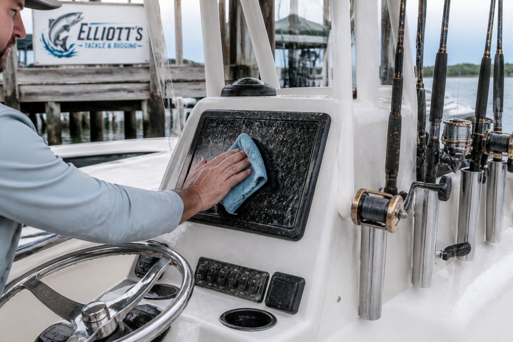
What to do after every saltwater trip:
- Rinse the screen and bezel with fresh water, never a pressure washer
- Dry with a microfiber cloth to avoid scratching the coating
- Check the connector pins for green corrosion and apply dielectric grease
- Inspect the transducer face for barnacles and wipe it clean
Marine Navigation Basics for Beginners: Charts, Waypoints, and Tracks
Marine navigation basics come down to three tools: charts, waypoints, and tracks. Learn these and you can run most inshore and nearshore water safely.
- Charts show depth contours, channels, and hazards. Read them before you leave the dock.
- Waypoints are saved positions. Mark your launch, your fishing spots, and any hazard you find.
- Tracks are the breadcrumb trail of where you actually went. Save the productive ones.
U.S. Coast Guard boating safety navigation resources
Networking and Budget: NMEA 2000, Screen Size, and What to Spend
NMEA 2000 is the standard network that lets marine electronics share data over a single powered backbone cable. Think of it as a spine running through the boat: each device, chartplotter, radar, AIS, autopilot, engine gateway, digital depth sounder, taps into that spine with a short drop cable and a T-connector. Two terminators cap the ends of the backbone to keep the signal clean.
A few practical rules worth knowing before you buy:
-
Check the backbone amperage. A single NMEA 2000 backbone has a limited current budget, and long runs with many devices may need a second backbone or a powered isolator.
-
Keep drop cables short. Long drops introduce voltage drop and intermittent faults that are maddening to chase on the water.
-
Match the network to the head unit. Not every chartplotter supports every NMEA 2000 parameter set. Confirm the unit reads engine data, tank levels, and autopilot heading if you plan to use them.
-
Label every connection. Salt spray finds loose connectors. A dab of dielectric grease on each pin at install time prevents most intermittent "my unit keeps rebooting" complaints.
-
Garmin GPSMAP 8610 Chartplotter GN+ ($2,549.99): a 10-inch full HD IPS touchscreen with preloaded Navionics+ charts and NMEA 2000 networking. A solid mid-size helm unit for coastal and lake boats.

Garmin GPSMAP® 8610 Chartplotter GN+ -
Garmin GPSMAP 8612 Chartplotter GN+ ($2,799.99): the 12-inch version, with no built-in sonar module so you can match your own transducer setup. Good for offshore builds.

Garmin GPSMAP® 8612 Chartplotter GN+ -
Garmin GPSMAP 8616 Chartplotter GN+ ($4,499.99): a 16-inch display with built-in sonar support for CHIRP, ClearVü, SideVü, and LiveScope. The pick for a fully networked offshore helm.

Garmin GPSMAP® 8616 Chartplotter GN+ -
Raymarine Element 12 HV Chartplotter & Fishfinder Combo ($1,238.99): a 12-inch combo with HyperVision sonar and RealBathy personal depth mapping. Strong value for anglers who want sonar and charting in one.
-
SI-TEX NavPro 1200F with Wi-Fi & Built-In CHIRP ($2,180.99): a 12-inch multifunction display with built-in CHIRP sonar, internal GPS antenna, and a Polaris chart card included.
Frequently Asked Questions
Is a chartplotter the same as a GPS?
No. A GPS receiver only calculates your position. A chartplotter combines that position with digital nautical charts, so you see your boat moving across depth contours, channels, and markers in real time. Most modern chartplotters, like the Garmin GPSMAP 8610, include an internal GPS receiver. A standalone handheld GPS gives coordinates but no chart display. For saltwater fishing, the chartplotter does the navigation work; the GPS is just one component inside it.
Do I need a chartplotter for saltwater fishing?
If you fish inshore flats, reefs, or offshore structure, a chartplotter helps you find and return to productive spots. It shows depth contours, waypoints, and your track over bottom features. Without one, you rely on landmarks and memory, which gets risky in fog or at night. A combo unit like the Raymarine Element 12 HV adds sonar to the same screen, so you mark fish and structure while navigating. For shallow bay fishing in clear conditions, a handheld GPS can work as a backup.
Can a handheld marine GPS replace a mounted chartplotter?
For small boats and kayaks, a handheld GPS handles basic positioning and waypoint marking. But it falls short offshore. Small screens are hard to read in direct sun, and handhelds lack the networking to connect sonar, radar, or autopilots. A fixed-mount chartplotter like the Garmin GPSMAP 8612 supports NMEA 2000 and Garmin Marine Network, so you can add a transducer, radar, and engine data on one display. Use a handheld as a backup, not your primary navigation system.
How do chartplotters integrate with fishfinders and transducers?
A chartplotter with built-in sonar support connects directly to a transducer, which sends sound pulses down and reads the returns. That data appears as depth readings and bottom images on the same screen as your charts. The Garmin GPSMAP 8616 supports CHIRP traditional, ClearVü, SideVü, and LiveScope sonar, with transducers sold separately. The SI-TEX NavPro 1200F includes built-in CHIRP sonar and an internal GPS receiver, so you add a compatible transducer and you're running.
0 comments