
*Free Shipping Over $129 - 30 Day Returns on Most Items - Most Items Ship in 1–2 Business Days

Garmin GPSMAP® 86i Handheld GPS w/inReach® & Worldwide Basemap


Garmin GPSMAP® 86i Handheld GPS w/inReach® & Worldwide Basemap
Capt. Joel will email you the moment this lands. No spam, one message.
Similar chartplotters we have in stock now
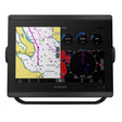 Garmin GPSMAP® 8610 Chartplotter GN+
$2,549.99 · In stock
Garmin GPSMAP® 8610 Chartplotter GN+
$2,549.99 · In stock
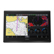 Garmin GPSMAP® 8616 Chartplotter GN+
$4,499.99 · In stock
Garmin GPSMAP® 8616 Chartplotter GN+
$4,499.99 · In stock
 Garmin GPSMAP® 86sci Handheld w/inReach® & BlueChart® g3 Coastal Charts
$629.99 · In stock
Garmin GPSMAP® 86sci Handheld w/inReach® & BlueChart® g3 Coastal Charts
$629.99 · In stock
Not sure what fits your boat? Call (360) 504-8112
The Garmin GPSMAP 86i is a floating, water-resistant marine handheld designed for demanding time on the water. A sunlight-readable 3-inch color display with full button operation keeps navigation straightforward in any conditions. Built-in inReach satellite communication ties into the 100% global Iridium network for two-way messaging, journey tracking, and interactive SOS backed by a 24/7 monitoring center. Wireless integration with compatible Garmin chartplotters, autopilots, and select FUSION marine products extends your onboard system to a handheld, and optional BlueChart g3 coastal charts deliver exceptional depth and detail wherever you need them.
Specifications:
- Floating, water-resistant handheld design
- Sunlight-readable 3" color display with dedicated button operation
- Built-in inReach satellite communication via the 100% global Iridium satellite network (satellite subscription required)
- Two-way text messaging, journey tracking and sharing, and interactive SOS with 24/7 global monitoring center
- Streams real-time boat data from compatible Garmin chartplotters and instruments
- Remote control capability for compatible Garmin autopilot and select FUSION marine products
- Adjustable GPS filter smooths speed and heading readings over swells
- Preloaded worldwide basemap included
- Supports optional BlueChart g3 coastal charts combining integrated Garmin and Navionics data
- BlueChart g3 charts include 1-foot contours for detailed bottom structure, improved fishing charts, and enhanced swamp, canal, and port plan coverage
- Receive marine weather forecasts directly on the device
- Smart notifications when paired with a compatible smartphone
- Syncs with Garmin Explore website for cloud-based management of waypoints, tracks, and routes
- Wi-Fi connectivity for wireless updates
- ANT+ and Bluetooth wireless technology
- Internal rechargeable lithium battery: up to 35 hours in 10-minute tracking mode; up to 200 hours in expedition mode (satellite subscription required; battery life varies by usage; battery is user-replaceable)
NOTICE: Some jurisdictions regulate or prohibit the use of satellite communications devices. It is the responsibility of the user to know and follow all applicable laws in the jurisdictions where the device is intended to be used.
Wi-Fi is a registered trademark of the Wi-Fi Alliance. The Bluetooth word mark and logos are registered trademarks owned by Bluetooth SIG, Inc. and any use of such marks by Garmin is under license. Sirius, XM and all related marks and logos are trademarks of Sirius XM Radio Inc.