

Table of Contents
- Why Keeping Marine GPS Charts and Software Current Matters
- What You Need Before You Start Your Marine GPS Updates
- Step-by-Step: How to Update Marine GPS Charts
- Step-by-Step: How to Update Chartplotter Software
- How to Use ActiveCaptain for Marine Updates
- Marine Chartplotter Software Update Frequency: How Often Is Enough?
- Troubleshooting Marine GPS Update Errors
- Frequently Asked Questions
Last Updated: September 16, 2026
Why Keeping Marine GPS Charts and Software Current Matters
Learning how to update marine gps charts and software is one of those boat-maintenance jobs that feels optional right up until it isn't. Charts change constantly: shoals shift after storms, buoys get repositioned, channels silt in, and marina entrances get re-marked. Software updates fix bugs, improve sonar rendering, and add features you already paid for.
The stakes are simple. A stale chart card can put you on the wrong side of a hazard you can see on screen but not on the water. An outdated plotter can freeze mid-run or drop your sonar overlay at the worst moment. Neither failure is dramatic until it is.
The good news: updating takes about 20 minutes once you have the right card reader and a current chart card. Here's the exact process.

What You Need Before You Start Your Marine GPS Updates
Gather four things before you touch the helm: your chartplotter's model number, a microSD chart card for your region, a card reader you can actually reach, and a stable power source.

The model number matters because chart cards are region-specific and compatibility varies by unit. Check the back of the display or the settings menu.
For card access, a remote reader saves you from crawling behind the dash every time. The Garmin USB Card Reader w/USB-C Adapter Cable gives you dual full-size SD slots in a flush-mount, IPX7-rated housing that connects to the back of your plotter via USB. The Raymarine RCR-1 Remote MicroSD Card Reader does the same job for microSD cards with a waterproof console-mount housing and an integrated USB socket.
Choosing the Right Chart Card for Your Waters
Chart cards are sold by coverage region, and picking the wrong one is the most common mistake we see. Match the card to where you actually fish, not where you might fish someday.
Card |
Coverage |
Best For |
|---|---|---|
Northern lakes, Great Lakes, rivers |
Great Lakes trollers, inland walleye and musky anglers |
|
East Coast coastal, lakes, rivers |
Striped bass and bluefish runs, inshore fluking |
|
Gulf and southern coastal waters |
Gulf of America redfish, speckled trout, nearshore trolling |
|
West Coast coastal, lakes, rivers |
Pacific Northwest salmon and halibut grounds |
Vision+ cards add relief shading and satellite imagery layers on top of the standard Navionics+ content. If you fish structure-heavy water where bottom contour reading decides your drift, the upgrade pays for itself.
Garmin USB Card Reader w/USB-C Adapter →

Step-by-Step: How to Update Marine GPS Charts
The chart update process is straightforward: back up your waypoints, pull the card, load new data on a computer, reinsert, and verify. Budget 20 to 30 minutes.
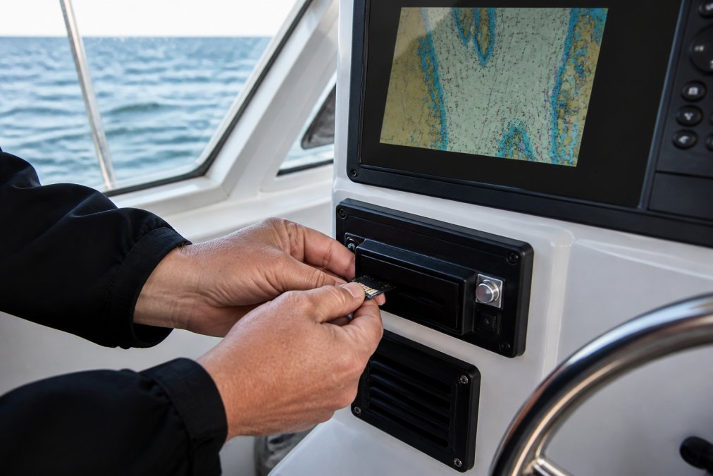
- Back up your waypoints and routes. Go to the plotter's data management menu and export everything to a separate SD card. Do this every time. Updates occasionally wipe user data, and rebuilding a season of waypoints from memory is miserable.
- Power down the plotter. Pull the chart card from its slot or from your remote reader.
- Insert the card into your computer using a card reader. Navionics cards ship with the first year of updates included; after that, you need an active subscription for the same coverage area.
- Open the Navionics Chart Installer software and sign in. The software detects your card and shows available updates.
- Download the update. This takes 10 to 20 minutes depending on connection speed.
- Eject the card safely, then reinsert it into the plotter.
- Power up and verify. Check that your home waters render correctly and that your waypoints are still there.
Updating Charts via microSD Card and Card Reader
The card-and-computer route is the most reliable method and the one to use when you have a strong internet connection at the dock or at home. A remote reader like the Garmin USB Card Reader keeps the card slot accessible so you're not disassembling your dash every update cycle.
Updating Charts Wirelessly Through Plotter Sync
Plotter Sync lets you push daily chart updates from the Navionics Boating app on your phone straight to a compatible chartplotter over Wi-Fi. It requires the app, a compatible smart device, and an active subscription for the same area. When it works, it's the easiest update path available. When the marina Wi-Fi is weak, fall back to the card method.
Step-by-Step: How to Update Chartplotter Software
Chartplotter software updates are separate from chart data updates, and skipping them leaves bug fixes and feature improvements on the table. The process takes about 15 minutes.
- Check your current version. Settings menu, then System Information. Write down the version number.
- Find the latest version for your exact model on the manufacturer's support page.
- Download the update file to a blank SD card formatted to the manufacturer's spec.
- Power the plotter from a stable source. Do not update on battery power alone. A voltage drop mid-flash can brick the unit.
- Insert the card and follow the on-screen prompts. The plotter will detect the file and ask to proceed.
- Do not touch anything during the flash. It takes several minutes and the screen may go dark.
- Confirm the new version number in System Information after the reboot.
How to Use ActiveCaptain for Marine Updates
ActiveCaptain is Garmin's community and update platform, and it's the fastest way to keep both charts and software current on compatible units. The mobile app pairs with your chartplotter over Wi-Fi and handles two jobs: pushing software updates and syncing chart data, waypoints, and community-sourced hazard reports.
Here's the workflow. Install the ActiveCaptain app on your phone, create or sign in to your Garmin account, and pair the phone with the plotter's Wi-Fi network. Once paired, the app checks for available software and chart updates automatically. You can also download chart regions ahead of a trip so the data is already on the plotter when you launch.
The community layer allows other anglers to flag new hazards, shifted channels, and shoaling, and those reports sync to your plotter. On busy water, that's local knowledge you'd otherwise have to learn the hard way.
Marine Chartplotter Software Update Frequency: How Often Is Enough?
For most anglers, updating charts monthly and software whenever a new version drops is a recommended cadence. If you fish the same home water year-round, quarterly chart updates are usually sufficient. If you travel or fish shifting inlet water, monthly updates are often beneficial.
Garmin USB Card Reader w/USB-C Adapter →
Situation |
Chart Update Frequency |
Software Update Frequency |
|---|---|---|
Same home water, occasional trips |
Quarterly |
When a new version releases |
Regular weekly fishing |
Monthly |
When a new version releases |
Traveling angler, multiple regions |
Before every trip |
When a new version releases |
Inlet, river mouth, or shifting bottom |
Monthly or after major storms |
When a new version releases |
Storm events are the wild card. A single tropical system can rearrange bottom structure in an inlet overnight. Update after any major weather event before you run that water again.
Troubleshooting Marine GPS Update Errors
Most update failures trace back to four causes: a bad card format, an interrupted download, insufficient power, or a card that doesn't match the plotter. Work through them in that order.
Plotter doesn't detect the card. Reformat the card to the manufacturer's required file system, usually FAT32 for cards under 32GB. Reinsert and retry.
Update stalls or fails mid-download. Your connection dropped.
Frequently Asked Questions
How often should I update my marine GPS charts?
Most chart cards, including the Garmin Navionics+ and Vision+ lines, include the first year of daily chart updates, with an annual renewable subscription after that. For anglers running the same waters weekly, updating before each season and after any major storm makes sense. If you fish multiple regions, update before you travel. Daily updates through Plotter Sync or the Navionics Chart Installer keep SonarChart HD contours, Community Edits, and dock-to-dock route guidance current so your marine GPS updates reflect actual conditions.
Can I update my marine chartplotter wirelessly?
Yes. Plotter Sync lets compatible Garmin chartplotters pull daily chart updates wirelessly through the Navionics Boating app on a smart device, as long as you have an active subscription for the same coverage area. This works with the Garmin Navionics+ and Vision+ cards, including the NSUS007R U.S. East and NVUS008R U.S. West. You still need the app installed and paired to the plotter. For software updates, most Garmin units also support Wi-Fi downloads directly from the device menu.
What do I need to update my marine GPS software?
You need your chartplotter powered up, a stable power source, and either a Wi-Fi connection or a microSD card with a card reader. The Garmin USB Card Reader gives your plotter dual full-size SD slots in an IPX7-rated housing and includes a USB-C adapter cable for newer displays. The Raymarine RCR-1 Remote MicroSD Card Reader offers a waterproof remote mount with an integrated USB socket. Both let you run software updates without crawling behind the helm.
Why do I keep getting marine GPS update errors?
The most common causes are a card formatted incorrectly, an interrupted Wi-Fi download, or a subscription that does not match the coverage area on the card. Pull the card, check it in a card reader, and confirm your Navionics subscription covers the same region. If the plotter freezes mid-update, do not power it off. Let it finish or restart cleanly. For persistent errors, back up your waypoints, reformat the card, and reload the charts from the Navionics Chart Installer.
0 comments