

Table of Contents
- Best Marine GPS for Fishing: Quick Comparison Table
- How We Selected the Best Marine GPS Units
- Marine GPS vs Fish Finder: Understanding the Difference
- Essential Features for Fishing GPS Systems
- Top Marine GPS and Fish Finder Models Reviewed
- How to Use Marine GPS for Fishing Success
- Where Each Marine GPS Wins: Scenario-Based Recommendations
- New vs. Used Marine GPS: What You Need to Know
Best Marine GPS for Fishing: 2026 Comparison Guide
Last Updated: July 10, 2026
When choosing the best marine GPS for fishing, durability, real-world accuracy, and integration with existing gear matter far more than marketing specs. At Elliott's Tackle & Rigging, we've spent four decades curating marine electronics for serious Pacific Northwest anglers. This guide explains which features translate to more fish in the boat.
The marine GPS market has fragmented into specialized ecosystems. A system excelling at tournament structure imaging might struggle with offshore navigation. The best marine GPS for fishing depends on whether you're chasing stripers in rivers, running offshore for tuna, or fishing shallow lakes.
Best Marine GPS for Fishing: Quick Comparison Table
Model |
Best For |
Key Strength |
Screen Size |
Primary Weakness |
|---|---|---|---|---|
Garmin GPSMAP 8616xsv |
Professional offshore anglers |
Panoptix LiveScope compatibility |
16" |
High cost |
Lowrance HDS PRO 12 |
Tournament fishing |
ActiveTarget 2 live sonar |
12" |
Advanced features require modules |
Humminbird HELIX 12 CHIRP MEGA SI+ |
Structure imaging |
MEGA Side/Down Imaging+ detail |
12.1" |
Non-touchscreen interface |
Furuno GP1971F |
Compact reliability |
Professional sonar in small package |
9" |
Limited screen real estate |
Simrad NSX 3012 |
Tech-forward anglers |
Android smartphone-like interface |
12" |
Requires separate transducer |
Raymarine Axiom 2 Pro 12 S |
Rough-water reliability |
HybridTouch keypad + touchscreen |
12" |
Premium pricing |
How We Selected the Best Marine GPS Units
We evaluated each unit across six categories: sonar clarity and target separation, GPS accuracy under signal obstruction, ease of use during active fishing, transducer compatibility and installation complexity, mapping software depth and update frequency, and long-term reliability based on field reports from professional captains.
Key Evaluation Criteria
- Sonar clarity and refresh rate: How quickly the system updates images and separates targets at depth.
- GPS accuracy and signal recovery: Real-world accuracy under tree canopy, near bluffs, and in canyons.
- Display technology and sunlight readability: IPS displays with high brightness maintain visibility in direct sunlight.
- Transducer compatibility and installation: Some units require proprietary transducers; others work with standard NMEA 2000 networks.
- Mapping software and bathymetric data: Preloaded charts, update frequency, and third-party compatibility.
- User interface consistency: Menu navigation speed and button responsiveness during active fishing.
Marine GPS vs Fish Finder: Understanding the Difference
A marine GPS chartplotter displays your position on electronic charts, records waypoints, and plots routes. A fish finder transmits sound waves and displays what's beneath the boat. Modern systems combine both functions into one display.
The distinction matters because they require different transducers. A GPS-only system gets you to the right location. A fish finder shows whether fish are actually there. The best marine GPS for fishing integrates both technologies seamlessly.
Essential Features for Fishing GPS Systems
Display Technology and Sunlight Readability
Screen quality determines whether you can see sonar detail in bright sunlight. IPS (in-plane switching) displays maintain image quality at wide viewing angles and typically measure 600-800 nits brightness, compared to 300-400 nits for standard displays.
Screen size ranges from 7 inches (compact, portable) to 16 inches (immersive detail). A 12-inch IPS touchscreen with 600+ nits brightness represents the sweet spot for most fishing applications, large enough to see sonar detail, bright enough for full-sun visibility, and responsive enough for quick menu navigation.
Sonar Capabilities: Down Imaging, Side Imaging, and Forward-Facing Sonar
CHIRP sonar transmits a range of frequencies simultaneously, improving target separation at depth. A 1kW CHIRP sounder outperforms 500W systems for detecting small fish and subtle structure changes.
Down imaging displays what's directly beneath the boat with photo-like clarity, revealing rock formations, submerged logs, and weed beds. Side imaging sweeps sonar beams left and right, creating a wide view of surrounding lake bottom. Forward-facing sonar shows what's ahead of the boat, invaluable for sight fishing.
The best marine GPS for fishing combines CHIRP sonar with either down imaging or side imaging. Forward-facing sonar is optional but increasingly valuable for competitive anglers.
Transducer Compatibility and Installation
Through-hull transducers mount permanently on the boat hull and deliver the best sonar performance. Transom-mount transducers clamp to the boat's transom with simple installation but degraded performance in rough water. Shoot-through-hull transducers mount inside the hull with acceptable but inferior performance.
NMEA 2000 networking allows multiple transducers to share one display. Proprietary systems lock you into one manufacturer's ecosystem.
Mapping, Cartography, and Bathymetric Data
Navigation accuracy depends on chart quality and bathymetric (depth) data accuracy. Garmin Navionics+, C-MAP 4D, and Humminbird Basemap represent the major cartography ecosystems.
Preloaded charts come with the system at purchase. Bathymetric data shows bottom contours and structure that concentrate fish. Chart updates vary by manufacturer, some update automatically via wireless connectivity. Third-party cartography compatibility allows you to load custom maps.
Top Marine GPS and Fish Finder Models Reviewed
Best Overall: Garmin GPSMAP 8616xsv
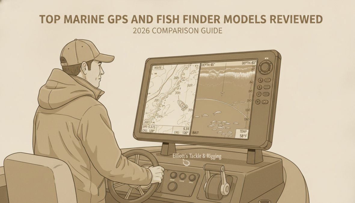
The Garmin GPSMAP 8616xsv represents the pinnacle of integrated GPS and sonar technology for serious offshore anglers. Its 16-inch full HD IPS touchscreen delivers exceptional clarity in direct sunlight and supports Garmin's Panoptix LiveScope technology, which displays live sonar video rather than traditional sonar images.
This unit handles Garmin's complete sonar ecosystem: CHIRP, ClearVü, SideVü, and Panoptix LiveScope simultaneously on one display. It integrates seamlessly with NMEA 2000 networks. Garmin Navionics+ cartography comes preloaded with detailed maps and updates automatically via wireless connectivity.
Pros: Unmatched sonar versatility, exceptional display brightness, seamless NMEA 2000 integration, comprehensive mapping preloaded.
Cons: Premium pricing, expensive transducers sold separately, steep learning curve for advanced features.
Best for Tournament Fishing: Lowrance HDS PRO 12
Tournament anglers depend on real-time sonar data. The Lowrance HDS PRO 12 delivers this through ActiveTarget 2 live sonar technology, which displays moving fish in real time.
The SolarMAX HD touchscreen offers exceptional sunlight visibility. Active Imaging HD produces cleaner sonar images than traditional CHIRP. This system integrates directly with Ghost trolling motors and Power-Pole anchors, allowing you to control boat positioning from the chartplotter menu.
Pros: ActiveTarget 2 live sonar unmatched for real-time fish tracking, seamless integration with Ghost and Power-Pole systems, responsive touchscreen when wet.
Cons: Advanced sonar features require expensive add-on modules, transducers sold separately, smaller ecosystem of third-party accessories.
Best for Structure Imaging: Humminbird HELIX 12 CHIRP MEGA SI+
Humminbird's MEGA Side and Down Imaging+ technology produces the sharpest structure detail in this price range, revealing submerged logs, rock formations, and weed beds with photo-like clarity.
The 12.1-inch display uses a non-touchscreen interface with physical buttons and keypad. This design remains responsive in rough water and prevents accidental menu changes. Dual Spectrum CHIRP sonar separates targets at depth better than single-frequency systems.
Pros: MEGA Imaging+ detail surpasses competitors, non-touchscreen interface excels in rough seas, excellent target separation, Ethernet networking for multi-display integration.
Cons: Non-touchscreen interface feels less modern, limited third-party accessory ecosystem, smaller user community.
Best Compact Option: Furuno GP1971F
The Furuno GP1971F delivers professional-grade sonar in a 9-inch footprint suitable for center console boats or tight helm spaces. The 1kW CHIRP sounder with RezBoost technology performs surprisingly well for its size. Compatibility with C-MAP 4D and Navionics charts provides access to detailed bathymetric data.
Pros: Professional sonar reliability in compact package, excellent chart compatibility, lower power consumption, simple intuitive interface.
Cons: Limited screen real estate for detailed sonar imaging, smaller community of aftermarket accessories, less intuitive touchscreen.
Best for Tech-Forward Anglers: Simrad NSX 3012
The Simrad NSX 3012 runs Android-based operating system, making menu navigation fast and wireless connectivity seamless. The 12-inch SolarMAX IPS touchscreen delivers excellent brightness. C-MAP X-Charts integration provides detailed mapping with quick autorouting.
Pros: Intuitive Android-based interface, fast autorouting and menu navigation, excellent display brightness, seamless wireless networking.
Cons: Requires separate transducer purchase, smaller user community, Android system may feel unfamiliar to traditional boaters.
Best Rugged Reliability: Raymarine Axiom 2 Pro 12 S
The Raymarine Axiom 2 Pro 12 S combines touchscreen and physical keypad in a HybridTouch interface that remains responsive in rough seas. The 12-inch display features HydroTough nano-coating that keeps the screen responsive when wet. High-CHIRP sonar delivers solid target separation.
Pros: HybridTouch interface excels in rough water, HydroTough coating maintains responsiveness when wet, fast processor handles multiple sonar streams, excellent ecosystem integration.
Cons: Premium pricing, smaller user community, less intuitive interface for unfamiliar users.
How to Use Marine GPS for Fishing Success
Setting Waypoints and Auto Guidance
Record waypoints when you catch fish, when sonar shows promising structure, or when marking hazards. Name waypoints and add notes about water temperature, bait used, and time of day. Auto guidance calculates routes between waypoints while avoiding shallow water and obstacles.
The most successful anglers maintain detailed waypoint logs with notes about conditions, species caught, and seasonal patterns. Your waypoint database becomes more valuable over time as you accumulate years of location data.
GPS Accuracy vs. Signal Obstruction: Real-World Considerations
Manufacturer GPS specifications claim accuracy within 3-10 feet. Real-world accuracy varies dramatically based on signal obstruction. Under open sky, modern GPS systems are accurate to within 5 feet. Near tall trees, canyon walls, or dense forest, accuracy degrades to 20-50 feet.
Some systems include WAAS (Wide Area Augmentation System) that improves accuracy to within 3 feet under ideal conditions. Check whether your system supports these augmentation technologies before purchasing.
Integration with Mobile Apps and Wireless Networking
Modern GPS systems connect to smartphones via WiFi, allowing you to view charts and sonar away from the helm. Garmin's ActiveCaptain app and Lowrance's Insight Genesis app offer comprehensive functionality. Test mobile app integration before purchasing if you plan to manage waypoints from your phone.
Maintenance, Firmware Updates, and Long-Term Reliability
Check manufacturer support timelines before purchasing. Some companies support systems for 10+ years. Others discontinue support after 5 years. Transducer maintenance includes annual inspection of through-hull fittings and periodic cleaning of transducer faces.
Where Each Marine GPS Wins: Scenario-Based Recommendations
For offshore saltwater fishing: The Garmin GPSMAP 8616xsv is the clear choice. Panoptix LiveScope capability justifies the premium cost when finding fish in deep water.
For tournament bass fishing: The Lowrance HDS PRO 12 dominates. ActiveTarget 2 live sonar provides real-time fish tracking that separates competitive anglers.
For structure-focused lake fishing: The Humminbird HELIX 12 CHIRP MEGA SI+ produces the sharpest images of submerged structure.
For compact boats or portable systems: The Furuno GP1971F delivers professional sonar in a tight footprint.
For anglers prioritizing ease of use: The Simrad NSX 3012 Android interface feels intuitive to smartphone users.
For rough-water reliability: The Raymarine Axiom 2 Pro 12 S HybridTouch interface remains responsive in rough conditions.
New vs. Used Marine GPS: What You Need to Know
The used marine electronics market offers significant savings but carries real risks. You can acquire flagship models at 40-50% of new prices, but transducers degrade with age and may require replacement. Previous owners might have used systems in saltwater without proper maintenance, accelerating corrosion.
Verify that the system powers on and displays menus before purchasing. Test sonar functionality if possible. Ask about maintenance history and whether transducers have been replaced recently. New systems come with full manufacturer support, current firmware, and warranty coverage. For serious anglers planning to keep the system for 10+ years, new equipment provides peace of mind.
Selecting the best marine GPS for fishing comes down to understanding your specific fishing style and investing in technology that supports your approach. Elliott's Tackle & Rigging carries professional-grade marine electronics hand-selected by captains with decades of field experience. Every system we stock has been tested on the water and proven reliable in the conditions where you'll actually fish. Visit Elliott's Tackle & Rigging to explore systems matched to your fishing goals, and benefit from FREE shipping and our 30-day returns guarantee on all marine electronics.
Frequently Asked Questions
What is the difference between a marine GPS and a fish finder?
A marine GPS is primarily a navigation and chartplotter tool that provides vessel positioning, waypoint marking, and route planning using coastal maps and bathymetric data. A fish finder uses sonar (CHIRP, down imaging, side imaging) to detect fish and underwater structure. Many modern units combine both functions into a single multifunction display with integrated sonar and NMEA 2000 networking for comprehensive water and navigation awareness.
What essential features should I look for in a fishing GPS?
Look for a sunlight-readable IPS or SolarMAX display, sonar capabilities (CHIRP and imaging options like down imaging or side imaging), transducer compatibility with your boat, preloaded coastal and bathymetric mapping, NMEA 2000 connectivity for autopilot and other marine electronics, waterproof rating (IPX7 or better), and a responsive touchscreen or hybrid keypad interface. Consider split-screen capability for simultaneous sonar and chart viewing, and wireless networking for sharing waypoints and data across devices.
How do I use marine GPS waypoints and auto guidance for fishing?
Mark waypoints at productive fishing locations using your chartplotter's GPS receiver—these save exact coordinates for future trips. Use auto guidance features to create routes between waypoints, allowing your GPS to guide you back to proven spots. Many units integrate with autopilot systems (NMEA 2000) to automatically steer to waypoints. Forward-facing sonar and live sonar features (like Garmin LiveScope or Lowrance ActiveTarget) let you see fish and structure in real time as you navigate, enhancing your ability to position the boat precisely over targets.
What are the risks of buying a used marine GPS?
Used units may have outdated firmware that limits compatibility with newer sonar transducers or mapping software. Touchscreen responsiveness can degrade over time, especially with saltwater exposure. Battery backup and internal GPS receiver accuracy may be compromised. Maps and cartography may be outdated, requiring costly updates. Warranty coverage is typically void or limited. Always verify the unit powers on, test the display in bright sunlight, confirm transducer compatibility, and check if firmware updates are available before purchasing used equipment.
Can I integrate my marine GPS with mobile apps and wireless networking?
Yes. Most modern marine GPS units support Wi-Fi and Bluetooth connectivity for wireless networking. Many offer companion mobile apps that let you view sonar, waypoints, and charts on your smartphone or tablet. NMEA 2000 networking allows integration with other marine electronics like autopilot and radar. Some units support cloud-based map updates and wireless transducer pairing. Check your specific model's specs for app availability, wireless range, and whether additional modules are required for full mobile integration capabilities.
0 comments